Another Gulf Island close to home is Saturna Island where I visited once this Summer. The small campground at Narvaez Bay on Saturna is part of the Gulf Islands National Park Reserve. Parks Canada instituted a reservation only policy for 2020, so I kept checking the website for an open site for two-day campout. Because everybody and their dog seemed to have taken up camping this year it took a while before I managed to snag a site for two nights.
Luckily the ferry to Saturna Island is direct from Swartz Bay on a morning, so not too long a trip to the southernmost Gulf Island. After arriving at Lyall Harbour on Saturna I waited for the vehicle traffic from the ferry to subside then set off up the brute of a hill that immediately greets one on East Point Rd. Making this bike ride more difficult was the fact that there is no potable water at Narvaez Bay campground and I already had a gallon on the bike (10 lbs) in various containers. But not enough for two days though, so after that first hill I stopped at the General Store located at the junction of East Point Rd. and Narvaez Bay Rd. to pick up another gallon! I loaded that on the bike and off I wobbled on Narvaez Bay Rd. for more hills!

Another short ride and a nice downhill run when I neared the park. Once past the the gate of the park there is a downhill trail for about one kilometre to reach the camping area proper. There are only 7 designated campsites at Narvaez Bay, hence the difficulty to obtain a site for two days. On a normal year (non-COVID) it is not that difficult to get a spot. Also, there is an overflow area (FCFS) but as on Galiano only recommended in dry weather as it get quite boggy after any serious rain. I set up camp at my designated campsite then went down to view the bay and watch a couple of boats mooring there.
Later, in the evening I took a stroll to the south end of the park at Echo Bay, a beautiful spot with views over Haro Strait to the San Juan Islands and Mount Baker in Washington State.


The next morning after some breakfast I set off for a hike to the summit of Mount Warburton. I knew that this would be a good hike with very good views from a high ridge looking westwards over the ocean towards South Pender Island and even Vancouver Island.
If one is not comfortable with heights, then a good portion of this trail would not be a good choice as there are some very steep and long drop-offs in many places.
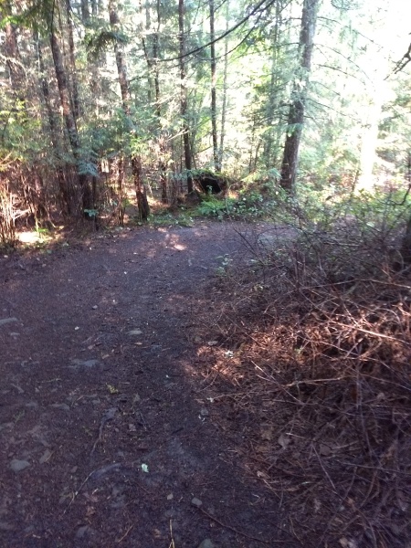
I had to walk on Narvaez Bay Rd. for the first 2 km or so until I reached the trailhead, then another almost 5 km to the summit at 402 metres (1320 feet), the highest summit in the Gulf Islands other than those on Saltspring Island. The hike to the ridge being the steepest grades through some bushy areas but nothing too challenging; once on the ridge, I definitely had to watch my step in many places! The ridge trail portion seemed to be well used by the look of it with long dry grass to either side and even though the track looked well used, I met no one in either direction making this hike very pleasant and peaceful. Really spectacular views from many sections of the trail, well worth a visit!
These next images are taken from various sections of the trail to Mount Warburton Pike


At the Summit there is a parking area if one chooses to drive there via Harris and Staples Roads, about 6 km from the ferry terminal at Lyall Harbour… But it is much more fun to hike there!
I hiked back to my campsite at greater speed due to mostly walking downhill for the return! Next up was R&R for the rest of day.
I packed up the next morning and cycled those bloody hills again back to Lyall Harbour where I waited for the ferry to Sidney.

The final Gulf Island that I visited only once was North Pender Island, with a hike to Mount Norman on South Pender Island. Both these Islands are interlinked by a short timber bridge and are known locally just as “The Penders.” Many years ago and prior to any bridge, the two Penders were one, accessible by a trail that First Nations peoples used. In 1903 a canal was dug to allow boat access through this channel, hence the requirement of the bridge over the canal.
My destination for camping was Prior Centennial Park. This park used to be part of the BC Provincial Park system, but a few years ago when The Gulf Islands National Park Reserve was created, the park became part of that national reserve. So once again, I had to bide my time to reserve a site for two nights due to the abundance of “COVID -campers” fleeing their indoor surroundings for the great outdoors!
Ferries to Pender Island are quite frequent as it is quite close to Swartz Bay on Vancouver Island and not a long trip.
Basil and I set off one bright sunny day for this two-day excursion. We arrived via BC Ferries at Otter Bay on North Pender, waited for the traffic to subside then rode up the first bloody hill out of the ferry terminal. Luckily this time, there is potable water at Prior so no need to haul that extra weight all the way there. “All that way” amounts to about 6.5 km, it just seems further with the bloody hills!
The ride to the park was uneventful, although there was a lot of traffic as the roads from the ferry, Otter Bay Rd. and Bedwell Harbour Rd., are the main route from the ferry to properties not only on North Pender but also on South Pender also. Tricky staying out of traffic’s way with a loaded bike on some of the more steep narrow sections of road. Just before reaching Prior, there is a small shopping plaza and a pub/restaurant nearby at Port Browning. I’ve camped at Port Browning before when it used to be $10 a night, now under new ownership it is still the same crappy sloping terrain camping area as before, the price has ridiculously jumped to between $50 and $80 per night – a complete rip-off!
From the shopping plaza to Prior are a couple of the worse hills to negotiate, but I persevered and found my designated campsite then unpacked and set up the tent etc. All of the 17 sites at Prior are amongst a tree covered canopy thereby shaded for the most part. To catch a little bit of sun and warmth, I had to keep on the move in my site to sit in different areas! I spent the rest of the day reading and relaxing or a taking a stroll around the park and general area.
During the first night, I was woken by the pitter-patter of raindrops on the tent fly! The rain persisted for most of the night leaving me with a completely soaked camping area. Luckily I had set up my sil-tarp to cover the entrance to my tent, so had a small area of dryness there when I exited the tent. Thankfully the rain had stopped in the morning leaving me the task of drying off my picnic table to get breakfast and coffee on the go.
My hike for this trip was to the summit of Mount Norman on South Pender Island. This would entail about a 2 km walk to the trailhead on South Pender then another 1 km plus to the summit. Once I reached the trailhead I could see that the trail was quite defined and well used. It was also evident that it was rising fairly steeply to reach the summit. Even the road from the bridge, Ainslie Point Rd., was quite steep to the trailhead.

After just starting out on the trial, I heard some people starting to make their way up after me, but otherwise saw no one on the trail to the summit, other than a big banana slug! I never did see who was behind me.
What a spectacular view when I reached the top of the trail at 244 metres (800 feet). The map shows the peak at 266 metres, but who’s arguing about a few metres! I stood on the convenient viewing platform for quite a while and marvelled at the vista.
These next images are taken from various sections of the trail to Mount Norman Summit


I didn’t want to return via the same route, but had scoped out via my map app that I could continue downhill to reach Canal Rd. on the east side of South Pender to make my return trip. This would be another 2 km to the road then another 4 km back to my campsite at Prior Centennial. Another solitary hike downhill on a trail that was much narrower and steeper than the previous section on the climb. So a good choice of direction!
After reaching Canal Rd. I walked for about 2 km towards the canal bridge and saw a sign for Mortimer Spit Park and a small side road. I wandered down to the spit and was surprised by finding a nice beach area after traversing the muddy road of the spit. It was obvious the beach access road could flood when tides were at their highest, so not a great place to take a vehicle! But from the looks of it, a few people do.
From the beach area I could see the canal and bridge joining the two islands and watched some boats cruising through.


After getting back to Canal Rd. I crossed the bridge to North Pender and legged it back to my campsite for a well deserved rest, some food and a nice glass of Scotch!
A good sleep that night and off to the ferry in the morning for the short sail home.
Once at home after all these excursions, I sat and pondered my trips throughout the Summer, and although COVID restrictions had curtailed any of my extended touring plans, I was very fortunate that the Gulf Islands are so near and accessible to me from my home in Sidney, allowing me to practice social distancing and limit my travels as recommended by the health authorities. All of the trips that I have written about do not involve a lot of cycling just some strenuous effort dragging my loaded bike up some of the islands’ bloody hills!
But without effort there is no challenge and no reward! I was certainly rewarded this year with some sights that I have not experienced before even though I have visited these Gulf Islands many times – it just shows that there is always something new if you are willing to look for it!
Finis!

Oh man, ylu really undersell Gallliano. I hope people read this comment to see how truly beautiful it is. So many nice hikes. I’m sorry you missed the good ones. Also, try to make your way to Deenisio next time. You’ll be the only one there and it’s spectacular but be ready for real hills. Gerri g to Mintagie is about ten percent of the incline you’ll be doing the rest of the way. It does have a lump ylu can filter water. Well worth it. Take the trail up to the bluffs next time. Well worth it. Take care.
LikeLike
Well, not really underselling I feel. I’ve been to Dionisio and camped there, it is a beautiful spot, but it is trespassing unless you are getting there by boat or backpacking there on trails. So I don’t advertise biking there. I’ve hiked other places on Galiano, and just in that particular post was where I went that time. I’ve got another upcoming post about another visit there when I hiked the Tapovan Peace park trails, also a good hike uphill with some bushwhacking down the other side. As far as hills past Montague, I’ve ridden them all on previous visits there numerous times on both roads heading north, Bodega Ridge Rd. is especially scenic in clear weather looking east to the Coast Mountains. FYI, I don’t blog about every bike tour/hike that I do, just memorable ones! Thanks for your perspective.
LikeLike
Hi Adam,
Thanks for the intel on Stockade hill. Strava shows me there is a trail (the Communication Tower trail) and I’m staying quite close to it, so I’ll have a look, but I am not committed to bushwhacking! You seemed quite dedicated to try to hike it twice.
LikeLike
Hi Dan:
I’ve looked for the Communications Tower Trail trailhead on Georgeson Bay Rd. when riding past where it should be, but have seen little evidence of it. It should be just north of Manzanita Hill Rd., but I’ve looked twice (by GPS location) and no luck so far. I didn’t look too hard as I was cycling to get the ferry home. If I get out there in a few weeks, I may try to hike it from the Tower back down to Georgeson Bay Rd. and see where I end up?
Trying to find the trailhead from Pattison Lane is also a bit of a challenge, definite bushwhacking there but the trail is close by and easily seen as it is quite wide there until it gets higher.
Good luck! Send me an email as to what you discover.
LikeLike
Have been to this Ruckle Provincial Park in mid 90-ties… Nice place indeed.
LikeLiked by 2 people